 This was a sunny Thursday with cloudy blue sky, a good time for outdoor photography. I went to Scarborough Bluffs again with my two photo buddies. This is my 3rd years taking photograph of the cliff scenes. Now the cliff top is securely fenced to prevent visitors from going too close to the cliff. But there is still an opening where people can walk closely to the cliff edge to appreciate the beauty of the lake.
A Journal of Memories, Images, Passions & Events, through the camera lens. http://peterbok.blogspot.ca
Saturday, August 17, 2013
A Sunny Scarborough Bluffs 晴朗的士嘉堡懸崖
at
2:00 AM
Posted by
Peter Bok 卜利泉
 This was a sunny Thursday with cloudy blue sky, a good time for outdoor photography. I went to Scarborough Bluffs again with my two photo buddies. This is my 3rd years taking photograph of the cliff scenes. Now the cliff top is securely fenced to prevent visitors from going too close to the cliff. But there is still an opening where people can walk closely to the cliff edge to appreciate the beauty of the lake.
Monday, August 12, 2013
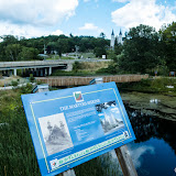
Wye River under the Hwy 12 bridge 12號公路下的惠河
at
2:01 AM
Posted by
Peter Bok 卜利泉
 Tay Shore Trail is located in the Tay Township in Ontario, Canada. It begins in Maubaushene and ends by the Wye River in Midland. The origin of Wye River starts at the central Tay Township and flows northbound to the Midland Bay. Wye River passes the Wye Marsh Wildlife Area, Sainte-Marie among the Hurons, Hwy 12, Martyrs' Shrine and finally reaches the Midland Bay.
 Monday, August 5, 2013
Wye River Trail 惠河郊遊徑
at
2:40 AM
Posted by
Peter Bok 卜利泉
 Tay Shore Trail is located in the Tay Township in Ontario, Canada. It originates from the east in Waubaushene, running through Victoria Harbour, Port McNicole and ends by the Wye River in Midland City. The construction of the Tay Shore Trail began in June 2006 and completed in September 2007. The length of the whole trail is 18.5km. The trail was paved with cement and is suitable for hiking and cycling. It has run through different small towns and renowned places of interest.
Subscribe to:
Comments (Atom)